Katsina State
Shifting sand dunes and land degradation in northern Katsina
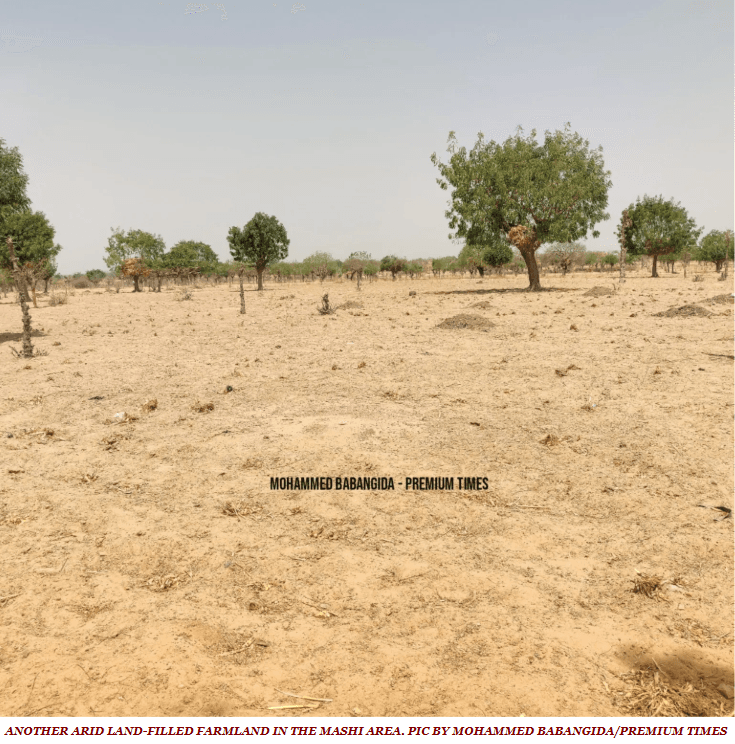
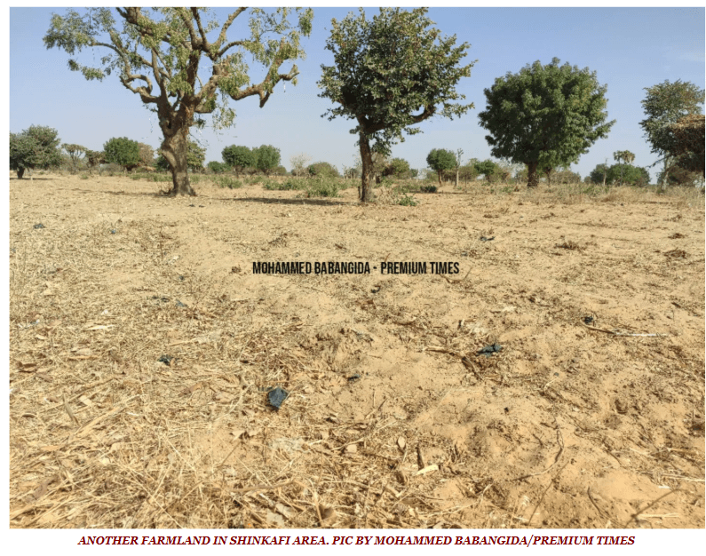
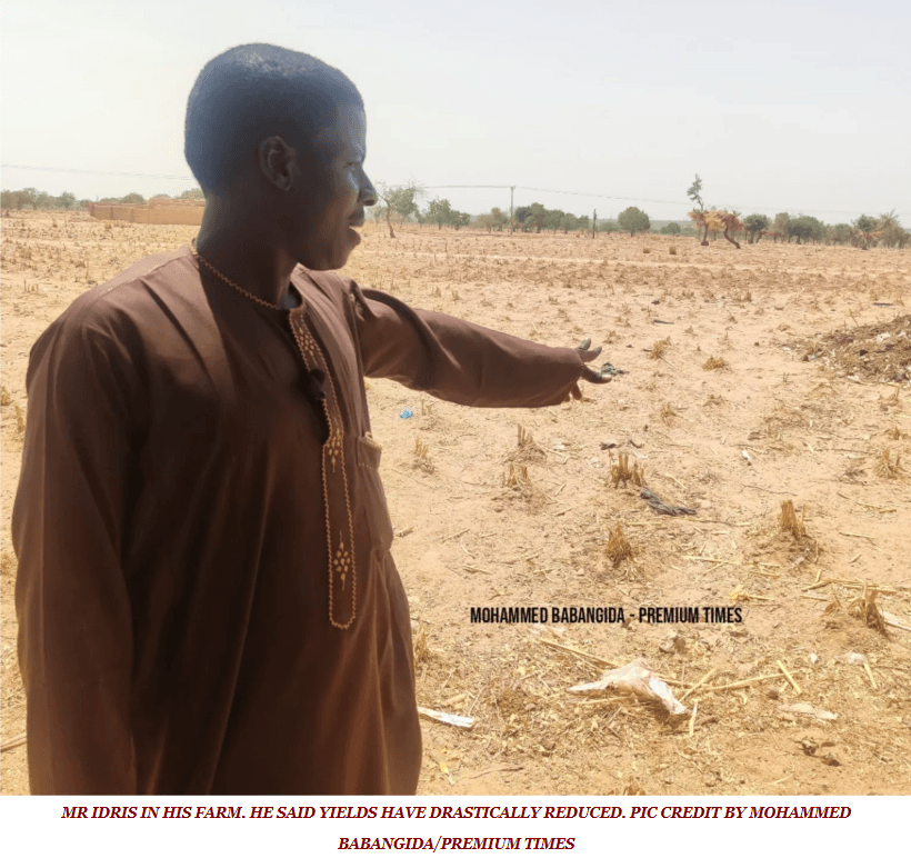
Across northern Katsina, Sahara-borne sand dunes, gullies and bare, near-vegetation-free land mark the advance of desertification – shrinking water bodies, depleting vegetation and biodiversity, and forcing communities in Jibia, Kaita, Mashi, Daura and Mani to defend their farms with windbreaks and agro-forestry. A 2004–2024 assessment found desertification risk concentrated in the northern parts of the state, where dunes form from material carried on strong dry-season winds off the Sahara. Field research in Jibia documents shrinking water bodies, depleted vegetation cover, shifting dunes and expanding bare ground. Yet the response has been slow – about three years into the shelterbelt programme, only some 28 km of belt had been established between Gurbin Baure in Jibia and Zurmi in neighbouring Zamfara.
Evidence and current condition
- A 2004–2024 study of Katsina found increasing desertification risk concentrated in the northern parts of the state, with complex vegetation dynamics captured in a risk-mapping framework for policy.
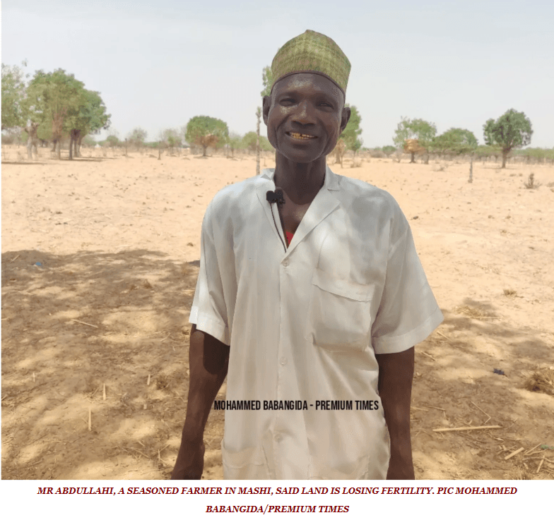
- Sand dunes, gullies and expansive land with little vegetation manifest the severity of desertification in northern Katsina, particularly in Jibia, Kaita, Mashi, Daura and Mani LGAs.
- The dunes form from eroded material carried by strong winds off the Sahara, especially during the dry season.
- Research in Jibia documents shrinking water bodies, depleted vegetation cover, shifting dunes, expanding bare ground and biodiversity loss.
- About three years into the shelterbelt programme, only some 28 km of belt – from Gurbin Baure in Jibia connecting toward Zurmi in Zamfara – had been established, illustrating slow execution.
Coordinates
| Area | Latitude | Longitude | Neighborhood |
|---|---|---|---|
| Jibia | 13.0890° | 7.2270° | Frontline dune belt near Niger border |
| Kaita | 13.1030° | 7.7080° | Northern frontline LGA |
| Mashi | 13.0130° | 8.2170° | Sand dunes and bare-ground expansion |
| Daura | 13.0300° | 8.3170° | Frontline drought LGA |
Required interventions
- Great Green Wall implementation through NAGGW in Katsina's frontline LGAs of Baure, Daura, Maiadua, Kaita, Mashi, Katsina, Jibia, Zango and Sandamu.
- Shelterbelt development linking Katsina's belt toward neighbouring Zamfara, plus integrated farming and water-harvesting infrastructure.
- Community coping measures – trees as windbreaks, woven-stick barriers around homes, agro-forestry and fadama farming – scaled up with government support.
- The World Bank-backed KTS-ACReSAL programme for semi-arid landscape restoration.
- Distribution of date palm and assorted seedlings under the NAGGW 50 million date palm programme across the frontline states.
Additional proof sources
- 1. Springer / Discover Environment – “Assessment of the influence of climate change on desertification in Katsina state, Nigeria” (2004–2024).
https://link.springer.com/article/10.1007/s44288-026-00403-x - 2. ResearchGate – “An Assessment of the Various Mitigation Strategies to Combat Desertification in Jibia and Kaita Local Government Areas of Katsina State”.
https://www.researchgate.net/publication/334949476_AN_ASSESSMENT_OF_THE_VARIOUS_MITIGATION_STRATEGIES_TO_COMBAT_DESERTIFICATION_IN_JIBIA_AND_KAITA_LOCAL_GOVERNMENT_AREAS_OF_KATSINA_STATE
Funding and support needed
Documentation is being prepared for implementation support and community participation.
Covers: Shelterbelt completion, dune-front stabilisation, agro-forestry and fadama support, and windbreak nurseries for frontline LGAs
Potential funding partners
Institutions aligned with this work
These are potential alignment examples, not confirmed funding commitments. Partner documentation will be updated as conversations progress.
How others can help
- • Donate to support field documentation, community workshops and restoration work.
- • Partner with the project for research collaboration and knowledge exchange.
- • Volunteer for data review, outreach or event support where available.