Plateau State
Tin mining legacy pollution, abandoned pits and heavy metal contamination
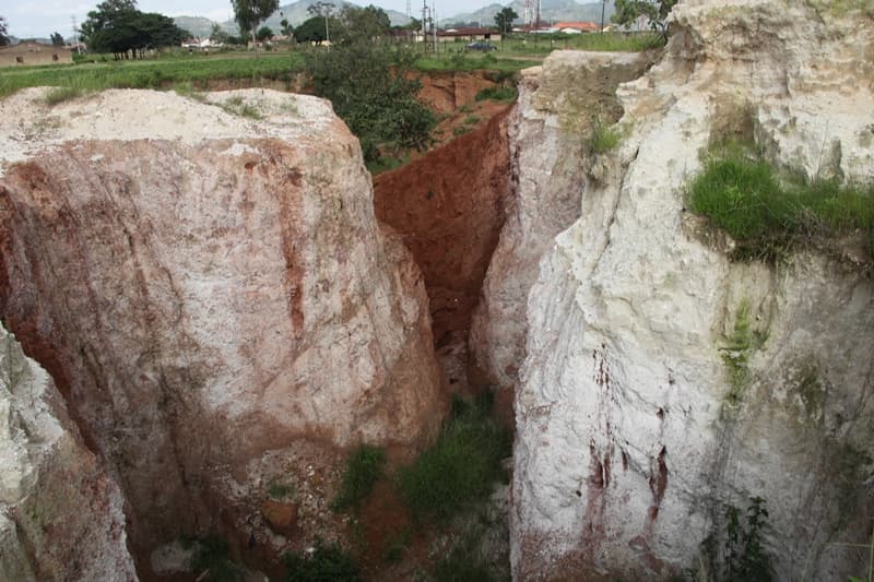
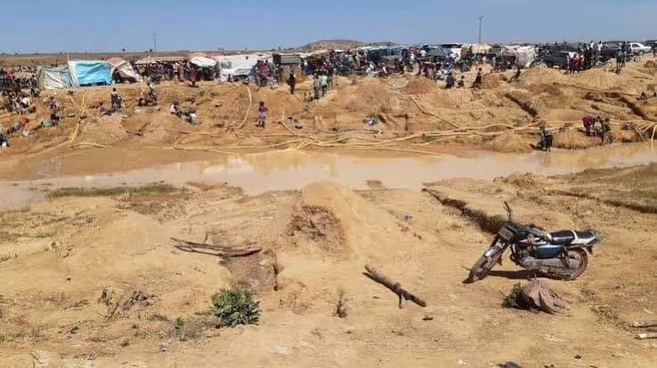
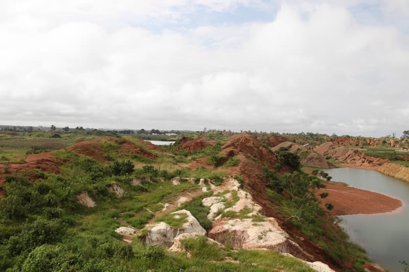
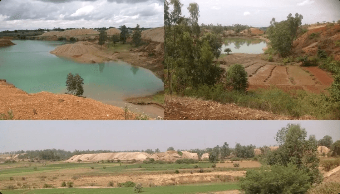
Decades of open-cast and artisanal tin mining on the Jos Plateau have left abandoned pits, contaminated soils and water bodies that continue to threaten farms, homes and children across Jos South and surrounding communities. Hundreds of abandoned pits and more than 1,000 water-filled ponds now cover roughly 17 km², creating drowning, collapse and contamination hazards. Soil studies report cadmium, lead, arsenic and selenium at levels above WHO guidelines, with the metals spreading into community soils and vegetables and raising the risk of child exposure. Ongoing artisanal mining keeps converting farmland into spoil heaps and open pits, deepening the region's long-term ecological and public-health burden.
Evidence and current condition
- Hundreds of abandoned mine pits and more than 1,000 water-filled ponds cover roughly 17 km² on the Jos Plateau, creating drowning, collapse and contamination risks across mining communities.
- Soil contamination studies in Jos Plateau mining areas report elevated cadmium, lead, arsenic, selenium and other metals exceeding WHO guideline values, with measurable spread into nearby community soils and vegetables.
- Research on tin mining sites points to higher child exposure pathways, especially through soil ingestion, food-chain transfer and contaminated water access near legacy pits.
- Artisanal and small-scale mining continues to expand land degradation in Rayfield, Du and surrounding villages, converting farmland and natural vegetation into spoil heaps and open pits.
- The legacy of industrial and artisanal mining is linked to altered hydrology, reduced agricultural productivity, and chronic ecosystem and public-health risks in the Jos-Bukuru complex.
Coordinates
| Area | Latitude | Longitude | Neighborhood |
|---|---|---|---|
| Rayfield | 9.8336° | 8.9119° | Rayfield Resort / Central Jos South |
| Du Communities | 9.8965° | 8.8583° | Active ASM & legacy pits |
| Zawan | 9.7595° | 8.8644° | Seasonal inundation & partial reclamation |
| Rantya | 9.8000° | 8.8667° | Mining sites & community soils |
| Kuru / Gada Biyu | 9.6964° | 8.8833° | Multiple mining clusters |
| Consolidated Tin Mines | 9.7854° | 8.8606° | Abandoned ponds |
| Jos International Breweries Mines | 9.8605° | 8.9075° | Industrial reuse of water |
| Shere Hills outer | 9.9500° | 9.0500° | Mining encroachment on heritage hills |
Required interventions
- Comprehensive inventory and prioritised remediation of the estimated 1,000+ abandoned pits and ponds across Jos South and adjoining LGAs.
- Systematic soil and water remediation at high-risk sites using phytoremediation, capping and engineered clean-up measures.
- Strict regulation and formalisation of remaining artisanal mining to prevent further expansion into farmlands and settlements.
- Long-term heavy metal and radiological monitoring in communities, food chains and water sources around mining clusters.
- Integration of mine-site rehabilitation into Plateau State climate resilience, land-use and restoration planning under ACReSAL and related programs.
Additional proof sources
- 1. Comparative analysis of concentrations of heavy metals in mining sites and community soils, Jos Plateau State, Nigeria (2025).
https://doi.org/10.4314/jobasr.v3i4.27 - 2. Comparative analysis of heavy metals in mining sites and community soils – article view.
https://jobasrfudutsinma.com/index.php/ojs-files/article/view/192
Funding and support needed
Documentation is being prepared for implementation support and community participation.
Covers: Site characterisation, pilot remediation, community engagement, monitoring and alternative livelihoods support
Potential funding partners
Institutions aligned with this work
These are potential alignment examples, not confirmed funding commitments. Partner documentation will be updated as conversations progress.
How others can help
- • Donate to support field documentation, community workshops and restoration work.
- • Partner with the project for research collaboration and knowledge exchange.
- • Volunteer for data review, outreach or event support where available.